Evidence posture
What the public record supports
Released Sources3
Approved Media7
Timeline Events4
Visible Uncertainties0
These counts describe this exact staff-approved public edition, not the private research workspace.
 Open full image
Evidence posture
These counts describe this exact staff-approved public edition, not the private research workspace.
Town Entry Standard v2
What happened here?
Built around petroleum development in 1865, Pithole City reached its greatest recorded activity in 1865–1866 and was in decline by 1867. Its history survives through newspapers, maps, and a contested historical account, while the record leaves the exact end of the town and the condition of its site unresolved.
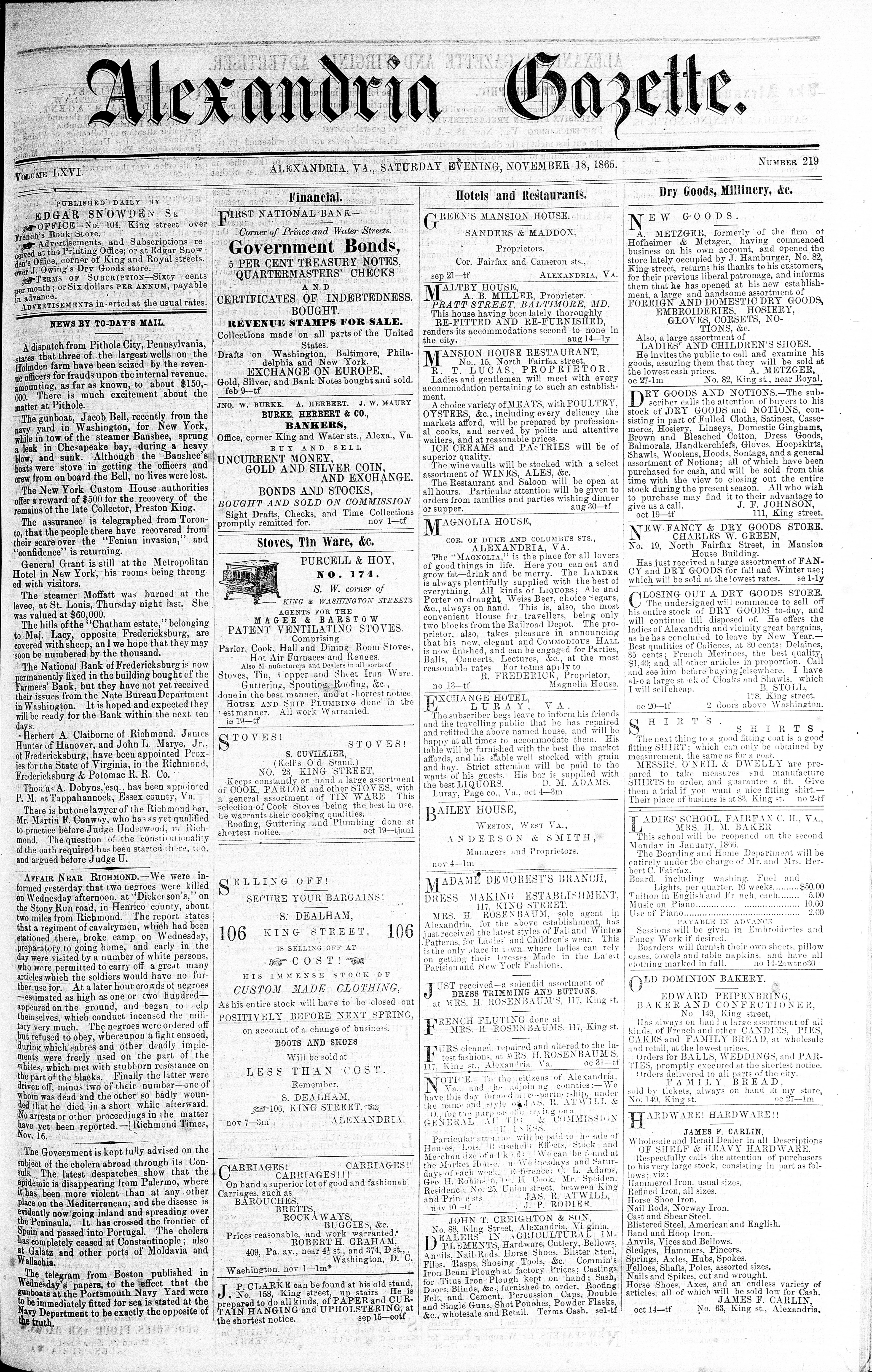
Pithole City was a petroleum boom town built in 1865, with its greatest recorded activity concentrated in 1865–1866. On November 18, 1865, the Alexandria Gazette reported a dispatch from “Pithole City, Pennsylvania,” placing the name in a contemporary newspaper record. Today, Pithole is identified as a former settlement rather than an extant town: a compressed history of development, peak activity, and decline.
According to the approved historical account, discovery by the United States Petroleum Company on the Thomas Holmden farm triggered development along Pithole Creek. The farm became the trade center, and the city was built in 1865. That summer, the New York Herald called Pithole Creek the “new oil regime” where sudden fortunes were made. The phrase records the newspaper’s view of the field’s promise; it does not independently establish how broadly or how long those fortunes were shared.
The available account places early settlers and backwoods residents of the township alongside oil workers, operators, and fortune seekers reported as arriving from across the United States and Europe. Drillers, teamsters, clerks, reporters, and printers appear in the occupational record, showing how the boom involved work beyond the wells. The 1867 history credits Thomas H. Brown with locating the Frazier well and reports George D. Davis Jr. selling oil there in January 1865. Its author, Charles C. Leonard—writing as “Crocus”—was also identified as a reporter for the Pithole Daily Record.
The United States Petroleum Company and the Pithole Creek Petroleum Company were among the institutions tied to Pithole, alongside the Pithole Daily Record. Businesses included Eddy’s Hardware Store, the Post Office News Room, and Morton, Longwell & Company. Holmden Street and Main Street appear in the street record; the U.S. Hotel, the Thomas Holmden House, and other buildings register in its built environment. The Frazier, Grant, Pool, Twin Wells, and Eureka wells anchored the petroleum landscape.
Petroleum extraction, exploration and drilling, oil transport, leasing, and speculation formed Pithole’s economic base. The historical account describes crowded arrivals, muddy travel, oil teams, derricks, and steam-powered drilling. Access involved a railway terminus followed by horses and coaches, while winter hauling to Titusville could be done by sleigh. Daily life was therefore closely bound to the movement of workers, equipment, and oil.
The boom’s pace is visible in its recorded sequence. The Frazier well began flowing approximately January 8, 1865; a long, narrow street was reportedly laid out on the Thomas Holmden farm on July 1; and Pool Well No. 54 was struck on August 28. Rapid construction and speculation followed. Fires affected oil-well areas in 1865 and 1866, while a February 1866 account described flowing surface wells and springs that disrupted access to ordinary water. The conditions that had drawn activity to the field were becoming more complicated.
By 1867, the approved record places Pithole in decline. It identifies declining production from many wells, fewer gushers, fire damage, and the movement of workers and oil activity to newly discovered fields as causes. A retrospective preface that year characterized the town as “tottering along on its last legs.” The record supports the broad trajectory, but not a complete or exact sequence of abandonment and disappearance.
A supplied 1945 retrospective states that Pithole underwent total disappearance, but no verified contemporary inventory of surviving archaeological or built features has been supplied. The surviving landscape is therefore unresolved in the approved record. Historical memory is more tangible: the 1867 volume The History of Pithole identifies “Crocus” as Charles C. Leonard, and a 1945 reprint preserved and interpreted that work. Its use requires care, however, because the author described the history as a collection of facts, fancies, and figures, and the later preface noted its serio-comic character. The accompanying image is illustrative rather than a documentary photograph of Pithole.
Historical dates
The July 30, 1865 article by New York Herald claims that Pithole Creek is the new oil regime where sudden fortunes are made.
CertainThe Alexandria Gazette reported on November 18, 1865 that a dispatch originated from “Pithole City, Pennsylvania.”
CertainThe title page identifies the 1867 volume as “The History of Pithole” and identifies “Crocus” (Chas. C. Leonard) as its author.
CertainThe September 10, 1884 Indianapolis Journal reported that on July 1, 1865, a long narrow street was laid out on the Thomas Holmden farm.
CertainCommunity record
The available account places early settlers and backwoods residents of the township alongside oil workers, operators, and fortune seekers reported as arriving from across the United States and Europe. Drillers, teamsters, clerks, reporters, and printers appear in the occupational record, showing how the boom involved work beyond the wells. The 1867 history credits Thomas H. Brown with locating the Frazier well and reports George D. Davis Jr. selling oil there in January 1865. Its author, Charles C. Leonard—writing as “Crocus”—was also identified as a reporter for the Pithole Daily Record.
The United States Petroleum Company and the Pithole Creek Petroleum Company were among the institutions tied to Pithole, alongside the Pithole Daily Record. Businesses included Eddy’s Hardware Store, the Post Office News Room, and Morton, Longwell & Company. Holmden Street and Main Street appear in the street record; the U.S. Hotel, the Thomas Holmden House, and other buildings register in its built environment. The Frazier, Grant, Pool, Twin Wells, and Eureka wells anchored the petroleum landscape.
Petroleum extraction, exploration and drilling, oil transport, leasing, and speculation formed Pithole’s economic base. The historical account describes crowded arrivals, muddy travel, oil teams, derricks, and steam-powered drilling. Access involved a railway terminus followed by horses and coaches, while winter hauling to Titusville could be done by sleigh. Daily life was therefore closely bound to the movement of workers, equipment, and oil.
Source transparency
LIBRARY_OF_CONGRESS
Contemporary NewspaperLIBRARY_OF_CONGRESS
Contemporary NewspaperGOOGLE_BOOKS
Kenya Approved ExceptionAttribution does not release preserved evidence files, provider locators, or private review notes.
Maps & Images
 Open full image
Historical newspaper page from LIBRARY_OF_CONGRESS; displayed from the exact reviewed source artifact.
LIBRARY_OF_CONGRESS![Full-page view of Image 2 of The New York herald (New York [N.Y.]), July 30, 1865.](/media/5042bf21-a17c-4b3e-8339-608ee0477c78) Open full image
Open full imageHistorical newspaper page from LIBRARY_OF_CONGRESS; displayed from the exact reviewed source artifact.
LIBRARY_OF_CONGRESS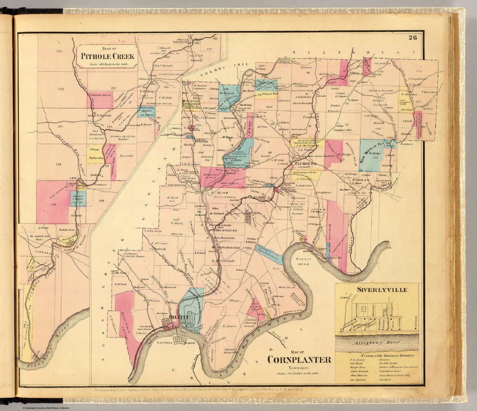 Open full image
Historical historical map from INTERNET_ARCHIVE; displayed from the exact reviewed source artifact.
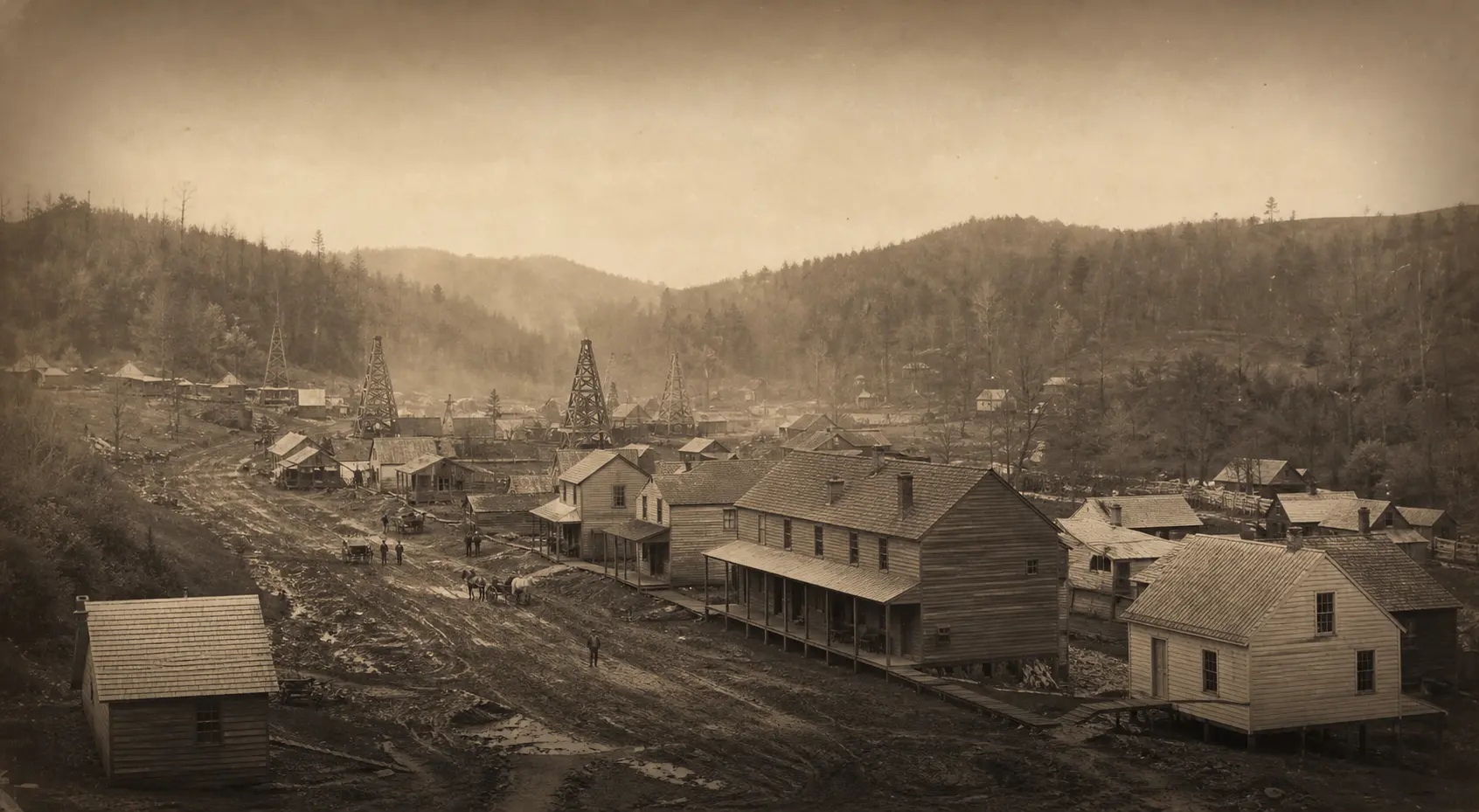
INTERNET_ARCHIVEOpen full imageArtist's visualization of an oil-boom settlement; decorative, not historical evidence
Vanished Towns original illustration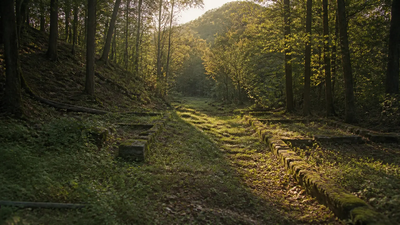 Open full image
Illustrative present-day landscape; not a documentary photograph of Pithole
Vanished Towns original illustration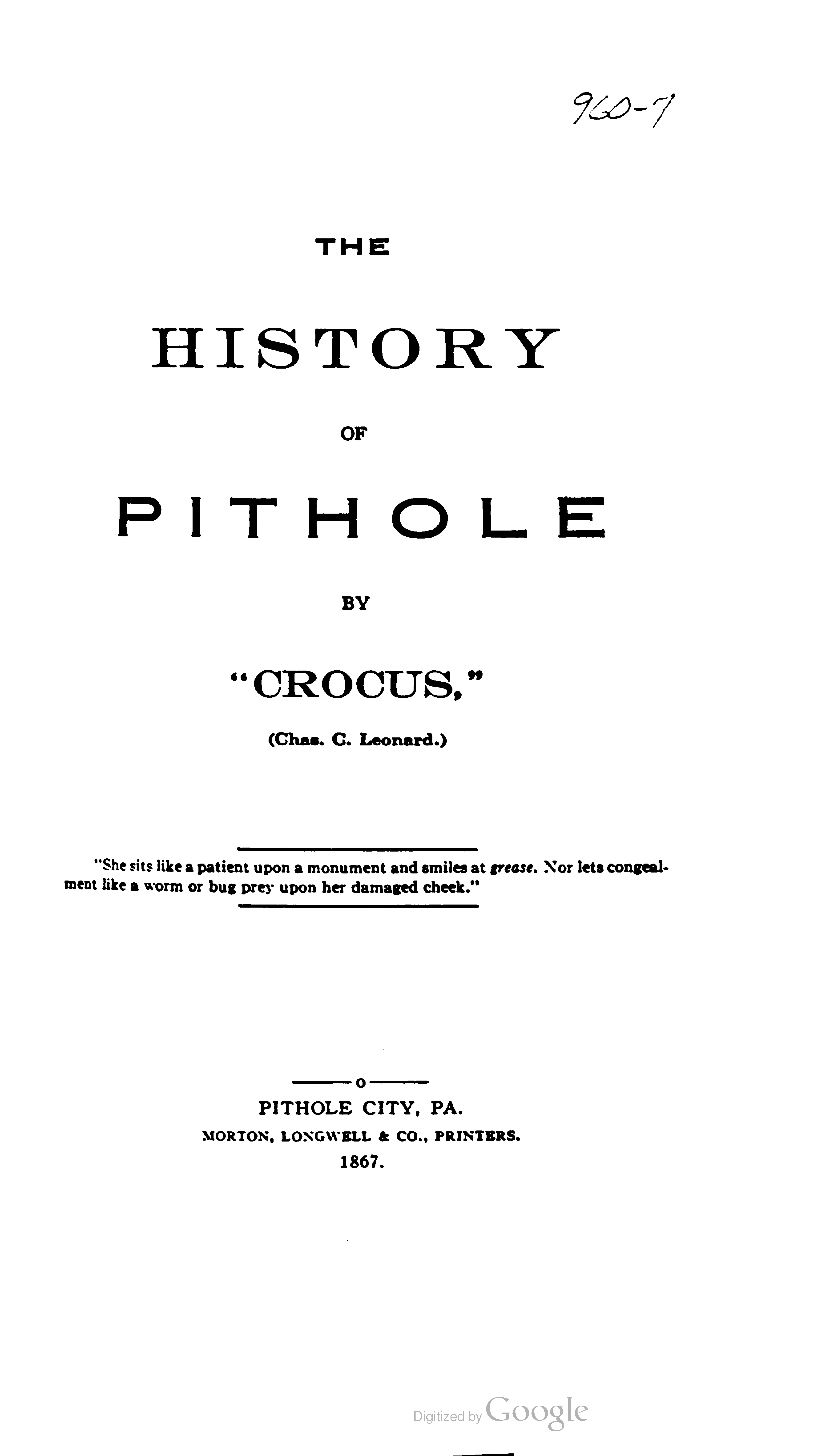 Open document page
Selected historical source document page from GOOGLE_BOOKS; displayed from PDF page 8 of the exact reviewed artifact.
GOOGLE_BOOKS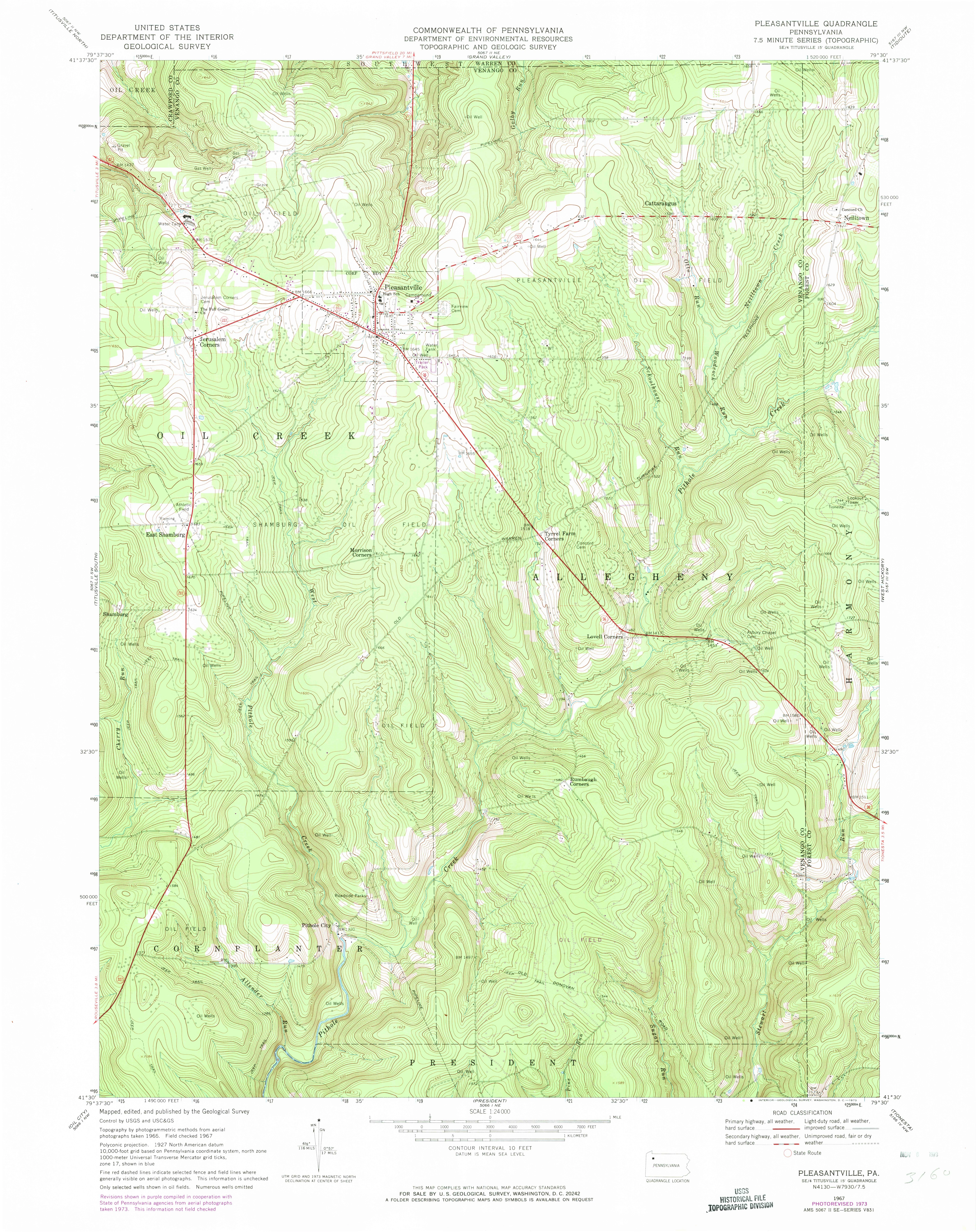 Open full image
Historical historical map from USGS_TOPOVIEW; displayed from the exact reviewed source artifact.
USGS_TOPOVIEWGeographic intelligence
No public location has been approved for this edition.
Open full imageHistorical mapHistorical historical map from INTERNET_ARCHIVE; displayed from the exact reviewed source artifact.
Open full imageInterpretive illustrationIllustrative present-day landscape; not a documentary photograph of Pithole
No location has been released publicly. Recorded uncertainties remain visible.